Edgewood (Washington, D.C.)
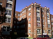
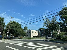
Place in the United StatesEdgewood is a neighborhood located in Ward 5 of Northeast Washington, D.C. Edgewood is bounded by Michigan Avenue NE to the north, Rhode Island Avenue NE to the south, North Capitol Street to the west, and the Washington Metro's Red Line to the east. The eastern boundary originates with the establishment of the former Metropolitan Branch of the Baltimore and Ohio Railroad in 1873, creating the physical barrier which today separates Edgewood from Brookland to the east.
Read article
Top Questions
AI generatedMore questions
Nearby Places

Rhode Island Avenue station
Washington Metro station
Trinity Washington University
Catholic university in Washington, D.C.

Rhode Island Avenue

St. Paul's College, Washington, D.C.
Catholic seminary school in Washington, D.C., United States

Glenwood Cemetery Mortuary Chapel
Historic site in Washington, DC

Dahlgreen Courts
United States historic place

Glenwood Cemetery (Washington, D.C.)
Cemetery in Washington, D.C

St. Mary's Cemetery (Washington, D.C.)
Cemetery in Washington, D.C., United States


